Abstract
The need to effectively manage and integrate large volumes of environmental data to support regulatory compliance and site remediation programs at SRS provided professionals the opportunity to explore spatial information technology as a means to accomplish information management goals. Since spatial relationships were inherent to the environmental data, GIS technology provided an effective means for intuitive access to the Site's environmental information. This paper describes the implementation of an integrated GIS and database management system, and the subsequent release of an SRS Legacy GIS Coverage CD as a communication tool. The systematic approach utilized evolved as a foundation for data consolidation across functional and organizational boundaries at the three hundred square mile site.
Introduction
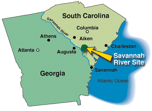
The need to effectively generate, manage, access, and analyze environmental and spatial data is essential to the current and future missions of the U. S. Department of Energy's Savannah River Site (SRS). SRS occupies approximately 310 square miles along the Savannah River, principally in Aiken and Barnwell counties of South Carolina (Figure 1). SRS is one of the several government-owned, contractor-operated sites in the DOE nuclear defense complex. While SRS still handles nuclear materials for government use and civilian purposes, the major focus has shifted to waste management and environmental restoration (WSRC, 1996). Efficient management of environmental and geographical data is particularly crucial to regulatory compliance, remediation analysis, restoration characterization, forestry management, ecological research, emergency response, site planning, and economic development activities.
Recently, a concerted effort was undertaken to
consolidate and integrate E&GIS data across organizational boundaries
at the Site. Moving through a difficult period of mission change and budget
reductions, SRS personnel saw the need to establish a central focus for
the management of environmental and GIS data. In addition to significant
cost savings, there were numerous benefits to be gained from a data quality
perspective. The integration effort was necessary to provide quality, consistent
data to preserve stakeholder trust in the Site's ability to protect the
public and the environment. After periods of minimal progress, the Site
now claims a high level of success in the E&GIS integration support
area. Achieving this level of success required careful management of institutional
issues in concert with technical issues. This paper describes the systematic
approach, the framework and techniques used, the challenges faced, and
the rewards of E&GIS integration at the Site.
Background
Since 1987, a steady, progressive evolution to improve the management of E&GIS information at SRS has been underway. A significant step was taken in January 1996 when five Vice-Presidents within Westinghouse Savannah River Company (WSRC) commissioned a team known as the Environmental and Geographical Information System (E&GIS) Corporate Steering Committee to define the actions necessary for integration and consolidation of SRS environmental, geological, and related geographical information. The union of environmental data and spatial information at SRS has become to be referred to as E&GIS (Environmental Data and Geographical Information Systems). The term "integrated E&GIS" refers to the users view that E&GIS information can be accessed and analyzed in a seamless environment.
Working with numerous SRS parties (WSRC, SRS
subcontractors, DOE-SR, Savannah River Ecology Laboratory, Savannah River
Forest Service), the E&GIS Steering Committee completed a comprehensive
functional requirements document and feasibility study. With five Vice
Presidents serving as the Policy Board overseeing the work, alternatives
and implementation tasks were evaluated for cost, quality, maintainability,
and schedule. The feasibility study recommended an integrated, centralized
E&GIS system to enable data sharing, less redundancy, consistency of
data, and lower cost for data capture and storage. The study also recommended
and the Policy Board approved a central organization to provide core technical
skills. This central organization, now known as the E&GIS Integration
Support Section, has worked over the past year to establish policies, priorities,
and budgets, perform integration tasks, and establish standards for environmental
and spatial data.
Baseline Environment
SRS maintains multiple hardware platforms and manages Oracle relational databases that store environmental monitoring, compliance, seismic, geologic, and other environmental data sets. These systems are available to all site users via the intranet. Past efforts have focused on migrating data stored in Oracle, Ingres, Filemaker, SAS, and other applications into a single, consistent database management system. SRS currently facilitates dynamic access to a centralized environmental database through both MGE (Intergraph) and ARC/View (Esri) GIS clients. The SRS supports developmental programs to improve the storage, access, and manipulation of environmental data and maintains a central repository of GIS "legacy" coverages that are available to all site users via the SRS intranet. Coverages and their associated metadata are updated by data stewards as the legacy information changes.
GIS coverages supported and maintained at SRS range from infrastructure and facilities to demography, biota, hydrography, hypsography, geology/seismology, cadastral, environmental monitoring, and cultural. These coverages are integrated through various GIS tools in support of:
Functional Requirements
Functional requirements for an integrated GIS and environmental data management system at SRS were extensively studied and documented (Table 1). The base objectives of the functional requirements were:
| Functional Requirement |
|
|
|
|
|
F | ||||||
| General Data Management Requirements |
|
|
|
|
|
|
||||||
| Data Availability Throughout the Project Life |
|
|
|
|
|
|||||||
| Efficient Data Input |
|
|
|
|
|
|
||||||
| Accurate Cost Estimates and Tracking |
|
|
|
|
|
|||||||
| Sample Tracking |
|
|
|
|
|
|
||||||
| Automated Invoicing |
|
|
|
|
|
|||||||
| Electronic Data Validation and Verification |
|
|
|
|
|
|||||||
| Consistent Use of Data Qualifiers and Reference Data |
|
|
|
|
|
|||||||
| Capture and Storage of Data |
|
|
|
|
|
|||||||
| Access to Required Data |
|
|
|
|
|
x | ||||||
| User-Friendly Interface to Data |
|
|
|
|
|
|
||||||
| Elimination of Redundant Data Sources |
|
|
|
|
|
|
||||||
| Known, Documented Data Quality |
|
|
|
|
|
|
||||||
| Standardized and Automated Report Generation |
|
|
|
|
|
|
||||||
| Comprehensive Documentation |
|
|
|
|
|
|
||||||
| Knowledgeable and Available Support Staff |
|
|
|
|
|
|
||||||
| Project Planning Requirements |
|
|
|
|
|
|
||||||
| Prepare Work Plan |
|
|
|
|
|
|
||||||
| Develop Sampling Analysis Plan |
|
|
|
|
|
|
||||||
| Develop Program Plan |
|
|
|
|
|
|
||||||
| Obtain Permits |
|
|
|
|
|
|
||||||
| Project Coordination Requirements |
|
|
|
|
|
|
||||||
| Mobilization Requirements |
|
|
|
|
|
|
||||||
| Sample Collection Requirements |
|
|
|
|
|
|
||||||
| Sample Analysis Requirements |
|
|
|
|
|
|
||||||
| Data Validation and Verification Requirements |
|
|
|
|
|
|
||||||
| Data Screening and Assessment Requirements |
|
|
|
|
|
|
||||||
| Data Summary Report |
|
|
|
|
|
|
||||||
| Report Generation Requirements |
|
|
|
|
|
|
||||||
| Storage and Management of Data Requirements |
|
|
|
|
|
|
||||||
Following the functional requirements analysis, a feasibility study, cost estimate, and manpower loaded project plan were prepared. The E&GIS system requirements included the cost-effective use of SRS's current investment in both Esri and Intergraph products and the corresponding legacy data sets developed using these application packages. Requirements include some "cross-platform" capability for access by the end-users.
E&GIS Integration Success Stories
On April 1, 1998, the E&GIS integration support effort will recognize one year of work as a formalized program. The list of accomplishments and cost savings initiatives are significant as detailed below:


Acknowledgments
Significant contributions to the E&GIS Integration
Project were made by many organizational entities. Participating organizations
included the U.S. Department of Energy, Westinghouse Savannah River Company,
Bechtel, U.S. Forest Service, and the University of Georgia Ecology
Summary and Conclusions
The E&GIS integration effort described in this paper was undertaken to consolidate and integrate E&GIS data across organizational boundaries. Having only been in formal existence for one year, the effort is making significant progress despite being in a difficult period of mission change and budget reductions. After years of minimal progress, the Site now claims a higher level of success in the E&GIS integration support area. As described earlier, a process improvement methodology was followed to determine and pursue the most effective implementation path. The net result has been significant progress in improving the management, access, consistency, quality and analysis of SRS environmental data resources. The use of GIS tools has been critical to Savannah River's success by facilitating a functional, attractive, inexpensive and easy-to-use method of analyzing and presenting environmental and spatial data.
Reflecting over last year, the recent success can be attributed to several factors:
End Note
This information contained in this
article was developed during the course of work under Contract No. DE-AC09-96SR18500
with the U.S. Department of Energy
References
Beckmeyer, R. R., 1998, White Paper on Environmental and Geographical Information Systems at Savannah River Site, Savannah River Site, Aiken, SC 29808.
Davis, F. B., and C. H. Hardy, 1995, Strategic Plan for Establishing an Integrated Geographical Information System at the Savannah River Site, WSRC-RP-95-730, Savannah River Site, Aiken, SC 29808.
Grewal, H. S. , 1997, A Study of the Economic Impact of the Savannah River Site on South Carolina and Georgia, WSRC-RP-97-00979, Savannah River Site, Aiken, SC 29808.
Huxhold, W. E., and A. G. Levinsohn, 1995, Managing Geographic Information System Projects, Oxford University Press, New York.
Mackey, H. E., and C. H. Hardy, E&GIS Project 2000, Savannah River Site, Aiken, SC ,1997, World Computer Systems, Final Feasibility Study for an Integrated Environmental and Geographical Information System at the Savannah River Site, Savannah River Site, Aiken, SC.
Story, C. H., and D. E. Gordon, 1993, Savannah River Site Environmental and Graphical Information Systems Program Plan, WSRC-RP-93-747, Savannah River Site, Aiken, SC 29808.
Westinghouse Savannah River Company Environmental and Geographical Information Systems Corporate Steering Committee, 1996, Implementation Plan for Establishing an Integrated Environmental and Geographical Information System at the Savannah River Site, Savannah River Site, Aiken, SC.
Westinghouse Savannah River Company (WSRC), 1996, Savannah River Site Environmental Report for 1992, WSRC-TR-93-076, pp. 4.
Westmoreland, M. B., 1997, Draft: Functional Requirements for an Integrated Environmental Data Management System in Support of Environmental Restoration Activities at the Savannah River Site, PCD-EGIS-97-0034, Savannah River Site, Aiken, SC.
World Computer Systems, Inc., 1996, Final Functional Requirements for an Integrated Environmental and Geographical Information System at SRS.
Author Information
Cheryl H. Hardy
Principal Engineer
Westinghouse Savannah River Company
Savannah River Site
Aiken, South Carolina 29808
phone: 803-952-6906
fax: 803-952-6849
cheryl.hardy@srs.gov