Chris Markel
A Transportation Information System (TIS) was developed to assist County, MPO, and RPO Planners in Pennsylvania in identifying and prioritizing transportation projects to be included in PennDOT's construction planning activities. The TIS was developed with ArcView to allow planning staff to identify potential projects using a variety of environmental, cultural, and PennDOT road and bridge information, and to prioritize and highlight the projects for presentation to PennDOT, MPO, and legislative entities.
The Transportation Information System (TIS) is an ArcView application for local planners to use to help them identify and prioritize transportation improvements (projects) in their areas. The TIS has been tailored for use in Pennsylvania by County Planning Commissions, Metropolitan Planning Organizations (MPOs), and Regional Planning Organizations (RPOs). The TIS relies on roadway, bridge, and project data supplied by the Pennsylvania Department of Transportation (PennDOT), as well as road centerline and Linear Referencing System (LRS) data provided by PennDOT. In addition, the TIS makes use of data provided by the Counties, MPOs, and RPOs, as well as data supplied by Commonwealth of Pennsylvania and Federal agencies.
PennDOT provides the funding and construction services for projects on 40,000 miles of State roads in Pennsylvania. PennDOT uses a 12-Year Plan for scheduling of major construction work, and an annual Transportation Improvement Program (TIP) for other project work. PennDOT solicits input and priorities from the MPO and RPO groups for projects in their service areas. The TIS is used by planners in County Planning Commissions, the MPOs and the RPOs to view roadway and bridge characteristics such as traffic volume, sufficiency ratings, Level of Service, and lane widths to help them determine where PennDOT should do improvement or construction work. The planners identify potential projects and collect information about the project areas using the TIS. The MPO and RPO groups then prioritize the projects for submission to PennDOT.
Funding for the TIS was provided by PennDOT to MPO and RPO organizations in Pennsylvania. The TIS was developed by Geo Decisions, a Division of Gannett Fleming, Inc., in State College, PA. Phase I of the TIS was completed in 1996, using ArcView 2.1. Phase II of the TIS was completed in 1999, using ArcView 3.1.
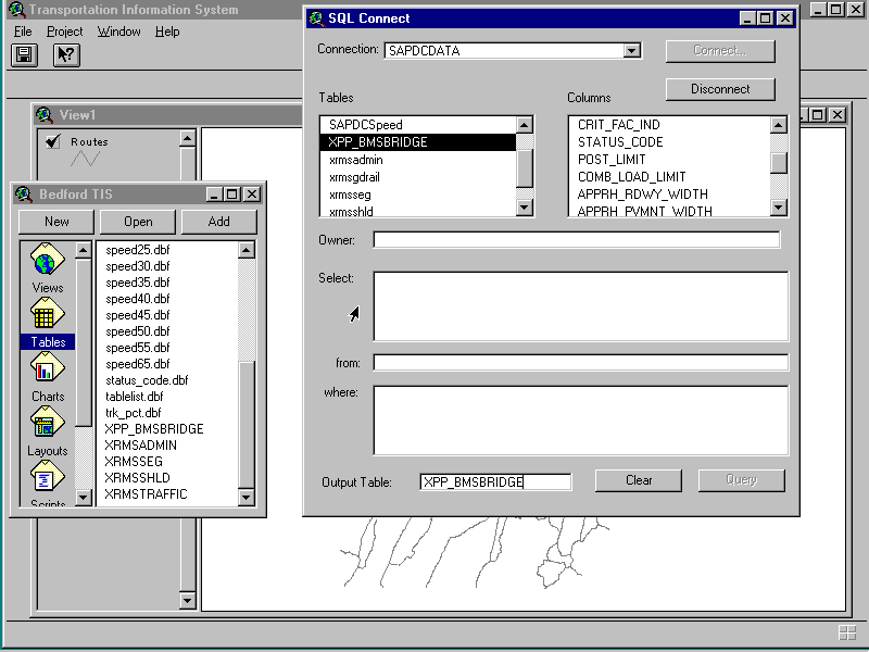
Much of the TIS data comes from PennDOT's GIS operations. PennDOT uses Intergraph GIS products, and data exchange procedures were developed for the translation and update of data from the Department to the TIS agencies. PennDOT maintains a Linear Referencing System (LRS) on the road centerline file in MGE, and the roadway, bridge, and project management system data is maintained in Oracle databases. The Department uses GeoMedia to supply data for use within ArcView. PennDOT supplies a road centerline file for each County, with the Department's LRS attached as attributes. ArcInfo is used to create an LRS route system for use in the TIS. GeoMedia is also used to create a Microsoft Access database containing tables corresponding to the Oracle tables. An ODBC driver is used to read the Access tables, and SQL Connect is used within ArcView to establish connections. The following figure shows some of details of the PennDOT data.
PennDOT Data Tables
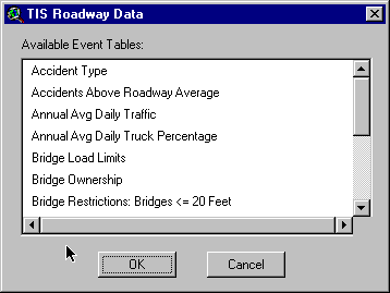
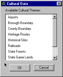
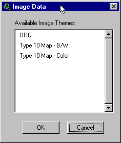
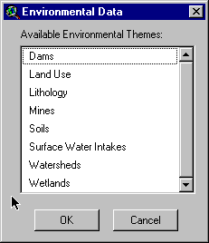
Other TIS data comes from the Counties and other sources. This is a variety of data layers that provide reference to the TIS, can delineate areas of concern, or may show an impact on transportation projects. The following figures show some of these data layers.
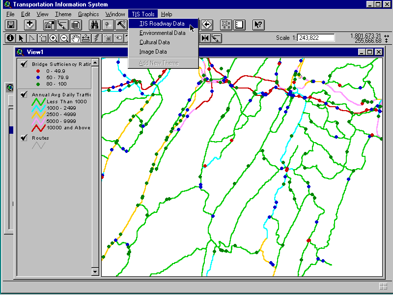
The TIS is developed using ArcView 3.1. It makes extensive use of the Dialog Designer extension, as well as the MRSid extension for images. The TIS has been implemented as both standalone project files (.apr), and as an ArcView extension (.avx).Several tools have been added to the View GUI, and menu additions have been made in the View and Project GUIs. The following graphic shows some of these additions.
PennDOT produces maps for each County maps called Type 10 Maps. These are included in the TIS to provide reference for areas.

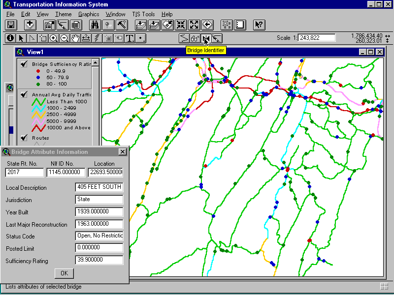
A Bridge Identifier tool was developed to allow users to click on a bridge location and see information such as bridge condition in a form. These dialogs include the PennDOT LRS information so that the planners can communicate with PennDOT staff about these projects and they can both work from a common locator.
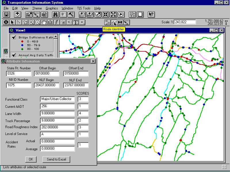
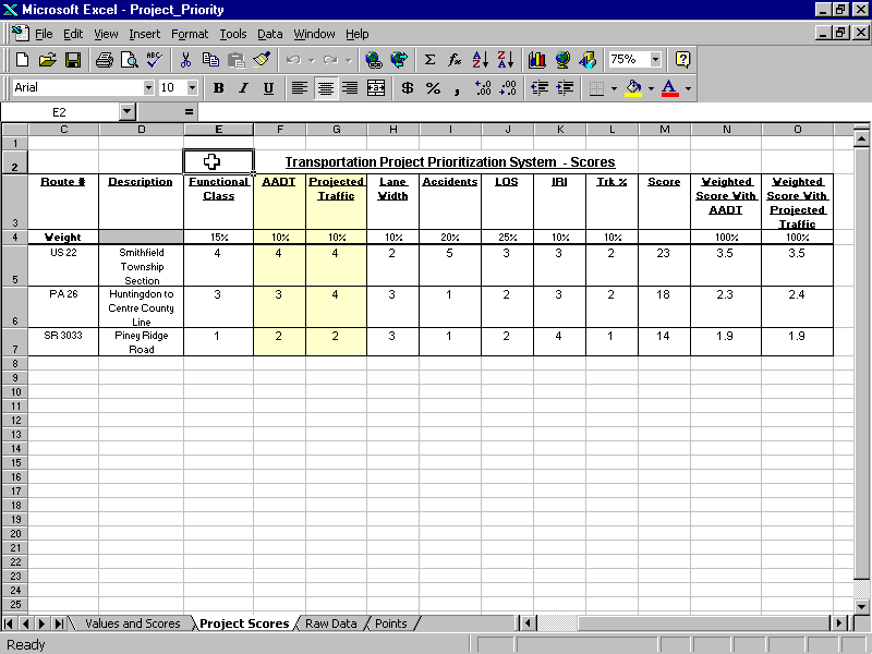
A Route Identifier tool was developed to allow users to click on a roadway and see information such as Level of Service in a form. The scores shown in the dialog form are calculated in the TIS according to criteria developed by the planners for each characteristic. The scores range from 1 to 5, where a 1 generally indicates a positive condition (e.g. wide lanes or low truck traffic) and a 5 indicates a characteristic of concern (e.g. high traffic or rough road). The scores for functional class range from a 1 for local roads to a 5 for Interstates. These scores are passed through a DDE connection to a Microsoft Excel worksheet used for prioritization.
This is the Excel worksheet developed by the planners for project prioritization. This allows the planners to adjust weights for each characteristic, and to rank projects according to their impact in the area.
County, RPO, and MPO planners in Pennsylvania are now using this product as they identify projects for their areas. The product also integrates with their other GIS efforts, as they can share this data with other projects and extend the TIS to bring in other information.
The assistance of the Pennsylvania Department of Transportation is greatly appreciated. In addition, the Southern Alleghenies Planning and Development Commission, the Lehigh Valley Planning Commission, and the Counties of Bedford, Cambria, Fulton, Huntingdon, and Somerset are all thanked for their efforts in this development.
Chris Markel
Senior GIS Analyst
Geo Decisions
Division of Gannett Fleming,Inc.