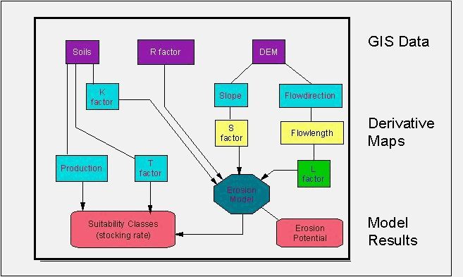
Figure 1. Flow chart illustrating methods used to derive grazing capacity using a GIS.