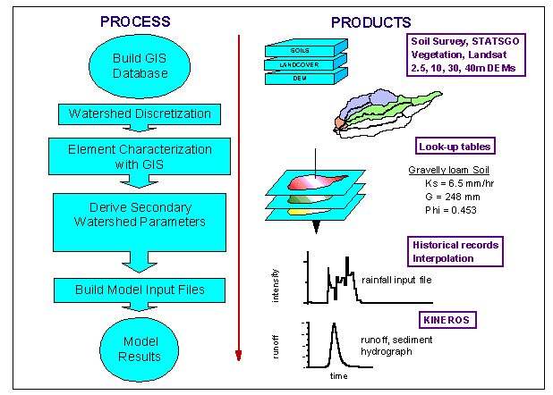
Figure 3. Schematic illustrating the use of GIS in the parameterization of distributed hydrologic models.