The parcel layer represents 15 000 ha, 20 000 parcels and 200 casdastral sections.
The prairie declarations are integrated with the parcel layer using a unique ID and constitute a 3,000 parcel layer.
The SPOT data, with its spatial and spectral resolution and its geometric precision, is particulary well adapted to the observation of biophysical land use.
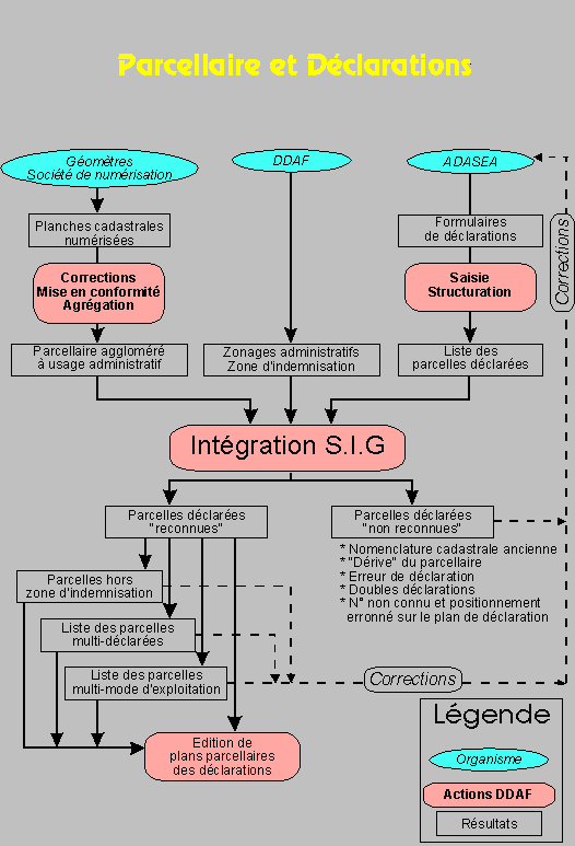
The processing developed during this procedure is summarized by the diagram below :