


The NDVI is employed using the average index by parcel.
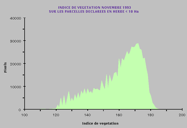
On the NDVI histogram we can observe "mineral" and "vegetal" modes and therefore two NDVI thresholds.
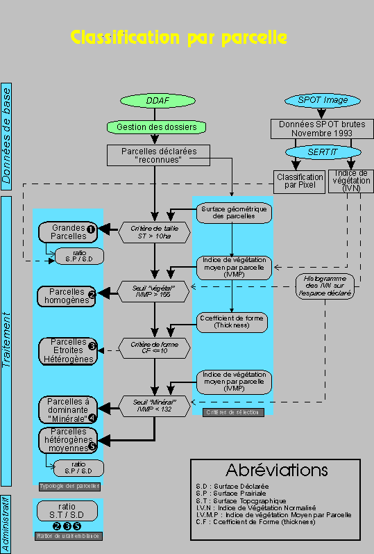
In order to perform this analysis a parcel selection process is carried out,based on parcel typology, according to their size, form, spectral homogeneity and declaration status, in order to affirm a parcels radiometric homogeneity.
The method as developed is resumed in this diagram :
The treatment results are :
Categorie                             Number          % surface
-----------------------------------------------------------------
big (type 1)                              27             12,6 %
homogenous grasslands (type 2)         2 372             72,3 %
small parcels (type3)                    216              3,5 %
bare soil parcels (type 4)                24              1,0 %
mixed parcels (type 5)                   251              9,9 %
outside flooding zone (type 9)            32              0,7 %
too small for the method                   2
-----------------------------------------------------------------
Total                                  2 924
In fact almost 85% of the declared parcels are homogenous grasslands.
As far as the 10% "mixed parcels" are concerned, a new and different relationship (based on ratios) is used to categorized them.
Only 1% are "bare soil parcels", the rest being comprised of parcels to which this process is difficultly justified due to parcel size.