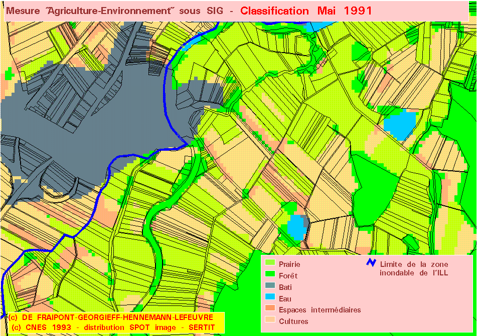
You can ascertain ground truth by looking at the following photos.
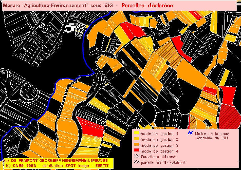
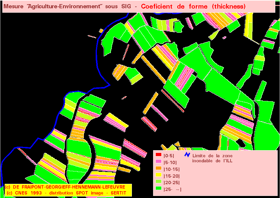
The largest declared parcels (> 10ha) who represent a minor declared surface area illustrate the limits of an administrative cadastre reference base for declaration.
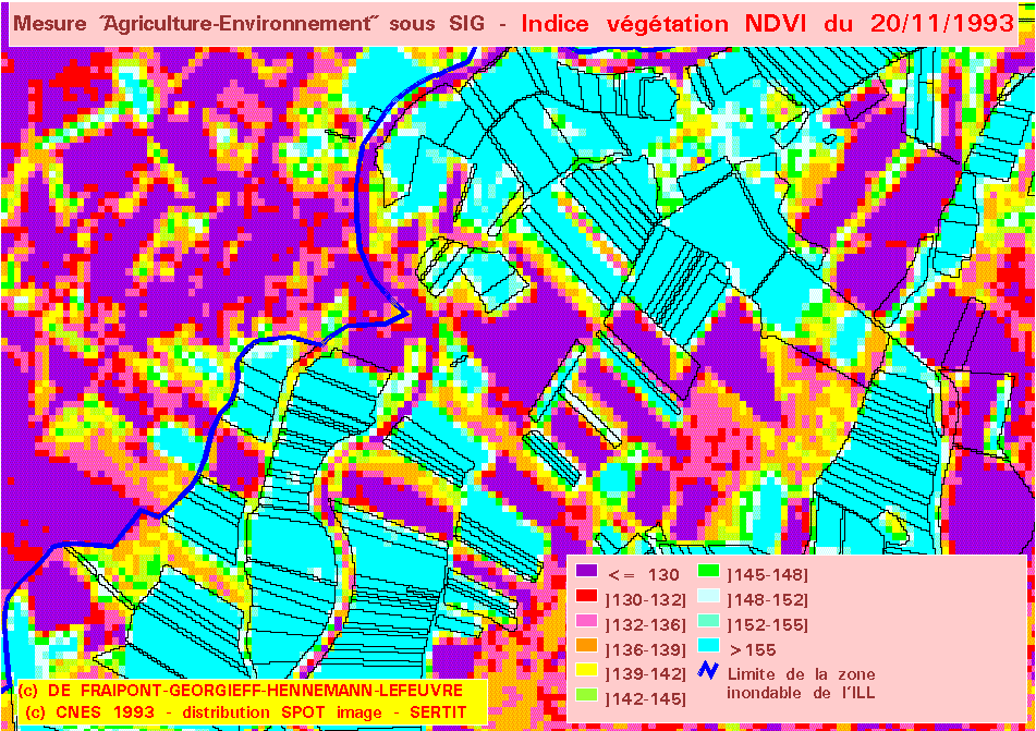
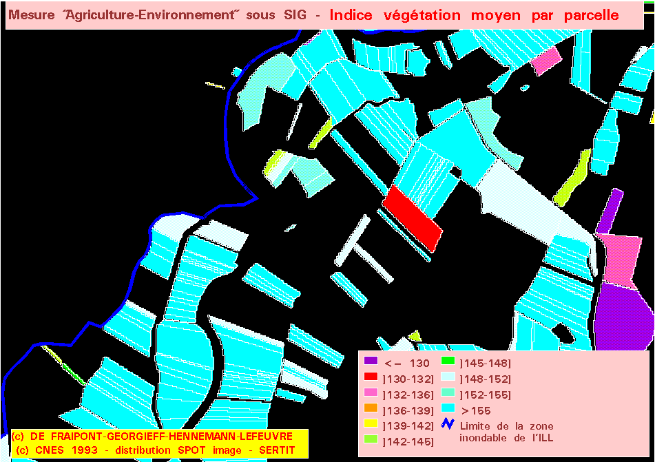
The averaged NDVI makes little sense vis-a-vis the very narrow parcels (3.5% of declared prairie surface).