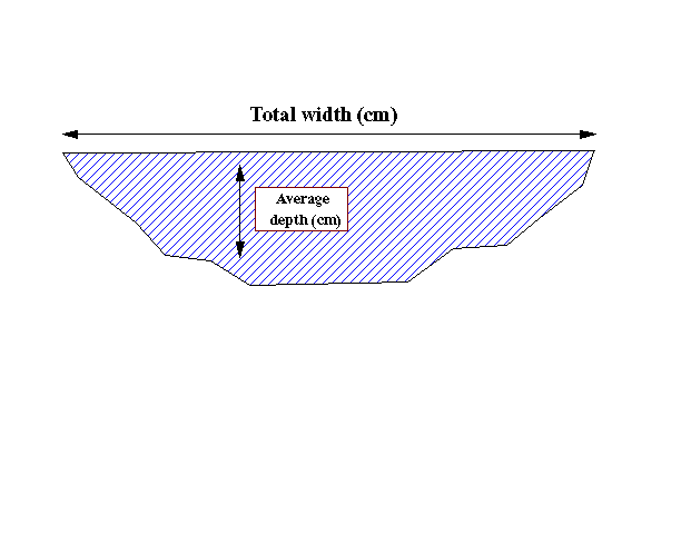
Idealized channel cross-section. Cross-sectional area = total width * average depth. Depth is measured at each break in slope and averaged as a function of distance from the left edge (looking upstream).
Sample data set of GIS-extracted and field-collected data for a subwatershed.
| site | 122 | order | 6 | |
| width:depth | 75.22 | cross-sectional area (m^2) | 17.98 | |
| channel width (cm) | 3670.00 | channel depth (cm) | 49.15 | |
| soil type | 1 | soil group | 1 | |
| watershed area ( m^2) | 22989300 | perimeter length ( m) | 36380 | |
| thickness (m) | 1485.4 | X-centroid | 598288.5 | |
| Y-centroid | 3510043 | X-outlet | 592437 | |
| Y-oulet | 3508240 | major axis (m) | 4668.202 | |
| minor axis (m) | 1567.567 | orientation (deg) | 20.310 | |
| mean elevation (m) | 1474.33 | minimum elevation (m) | 1379.96 | |
| maximum elevation (m) | 1672.02 | elevation change (m) | 292.07 | |
| sum of channel length (m) | 177468.2 | maximum flow length (m) | 14944.44 | |
| average slope (deg) | 51.17 | area:perimeter | 631.92 | |
| basin shape | 9.71 | relief ratio | 0.02 |